
GIS Resources
Spatial and Numeric Data Services guide to GIS data available at the University of Calgary.
GIS Help
Courses
- University of Calgary users have free access to Esri's training courses, which offer self-paced web based courses on specific GIS topics Accessing Esri online training
GIS and Cartographic Resources:
- ArcGIS Technical Support
- Esri GeoNet share, chat, and collaborate on all things geo
- Esri Support Center
- Install ArcGIS ArcMap on a student, staff or faculty personal computer UofC Service Now
- Install ArcGIS Pro on a student, staff or faculty personal computer UofC Service Now
- Obtain an Esri Account for access to Esri's online training, ArcGIS Online and ArcGIS Pro UofC Service Now
- GIS Stack Exchange question and answer site for cartographers, geographers and GIS professionals
- HELP Guides and Tutorials OCUL Geospatial Portal

- Cartographic Design and Development UK Ordnance Survey
- Cartography and Visualization Resources for GIS Stanford Geospatial Center
- UBC Library Research Commons Open GIS Workshop Materials

How are GIS files organized?
- National Topographic System (NTS) most Canadian GIS files are organized by a 1:50,000 or 1:250,000 scale grid:
- Atlas of Canada Toporama enter location, use
 tool to find NTS Mapsheet
 - Canadian Geographic Names Database provides NTS map sheet grid, ATS location, latitude/longitude
- Atlas of Canada Toporama enter location, use
- Alberta Township System (ATS) many Calgary and Alberta GIS files are organized by section-township-range-meridian
- City of Calgary Alberta Township Sections zoom in and click on area of interest; in the popup box information look for ats_section_no; ex. 182415 refers to Section 18 Township 24 Range 1 West of the 5th meridian
- LSD Finder (aka Grid Atlas) zoom and click for ATS, also UTM, latitude/longitude, and address
- GeoDiscover Alberta navigate to your area of interest, then determine NTS or ATS by clicking on the appropriate layer
GIS Tools
- QGIS A Free and Open Source Geographic Information System. Runs on Windows, MacOS and Linux.
- Awesome Geospatial - Long list of geospatial analysis tools. Geospatial analysis, or just spatial analysis, is an approach to applying statistical analysis and other analytic techniques to data which has a geographical or spatial aspect.
- The history of open-source GIS tools - An interactive infographic from makepath that touches upon open-source GIS tools.
Citing GIS Sources
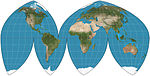
Projections
- What are map projections? Esri
- Wikipedia List of map projections
- Comparing Map Projections Kai's Block
- Map Projections Future Mapping Company
- Commonly used in Canada: