
Victorian Britain - Address Geocoding
This guide contains tools and sources for geocoding addresses in Victorian Britain. It was developed for the Victorian Literary Sociability project.
National Grid Converters
-
OS National Grid Reference converterThis tool can be used to convert between National Grid References and latitude/longitude coordinates.
-
UK Grid Reference FinderTool for finding the UK grid reference, northings/eastings, and latitude/longitude for any UK location.
British Geological Survey Coordinate Converter - converts British Nation Grid Reference to latitude and longitude. Two step process: first change the National Grid Reference to easting and northing using this Excel tool; then use the site to change the easting/northing to latitude/longitude.
Postal Geography
Other Resources
-
Geograph Britain and IrelandThis site collects geographically representative photographs of every square kilometre of Great Britain and Ireland.
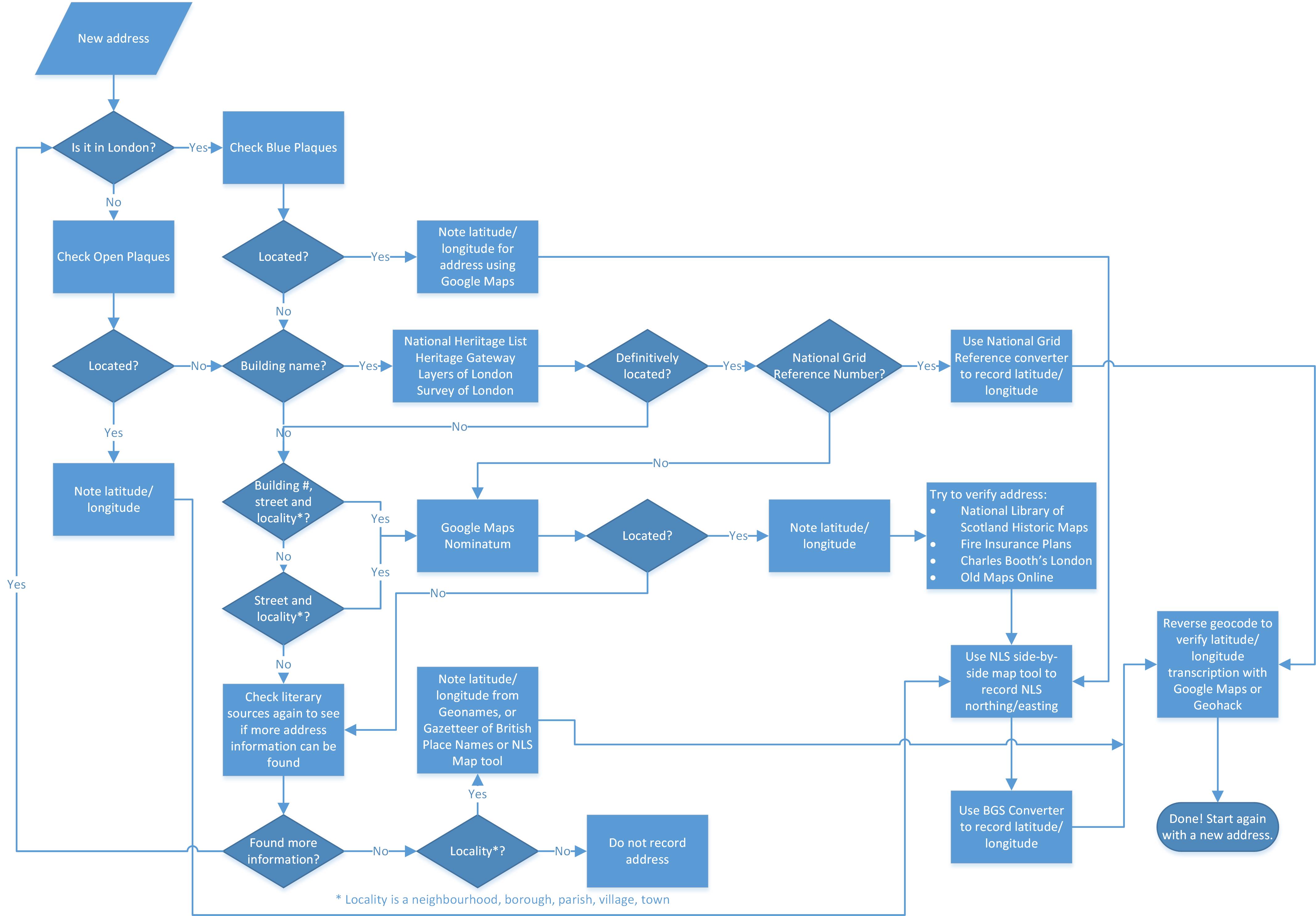
Geocoding Process Flowchart
Download Geocoding Flowcart (seen below)
